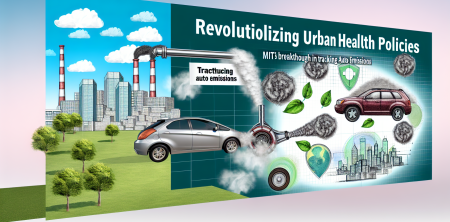
In a groundbreaking study published on April 2, 2026, researchers from the Massachusetts Institute of Technology (MIT) have unveiled a new technology that could significantly reshape public health policies in urban areas. This innovative system enables city officials to create high-resolution, real-time maps of auto emissions, offering critical insights into air quality and its direct impact on health.
Understanding the Impact of Urban Auto Emissions
Air pollution, particularly from vehicle emissions, has long been linked to a range of health issues, including respiratory diseases such as asthma, cardiovascular problems, and even premature death. In urban settings, where traffic congestion is prevalent, the challenge of managing air quality becomes even more pressing. MIT's latest research focuses on the implications of these emissions for public health, particularly among vulnerable populations.
High-Resolution Mapping Technology
The key innovation presented in the study is a technology that generates real-time data on auto emissions. By utilizing advanced sensors and data analytics, researchers can produce detailed maps that reflect the concentration of pollutants in specific areas. This technology provides a level of granularity that was not previously available, allowing for a more nuanced understanding of how emissions vary across different neighborhoods and times of day.
Application in Urban Peru
The MIT research team applied this technology to urban areas in Peru, where they assessed the emissions impact on local populations. The findings revealed critical patterns in air quality that correlate with the incidence of health issues. For example, neighborhoods with higher traffic volumes exhibited increased levels of pollutants, which were directly linked to elevated rates of respiratory illnesses among residents.
Empowering Local Health Policies
The implications of this research are profound. By providing cities with accurate, real-time data on auto emissions, local governments can make informed decisions regarding health policies and interventions. For instance, they can:
- Identify High-Risk Areas: The mapping technology allows officials to pinpoint neighborhoods most affected by poor air quality, enabling targeted health initiatives.
- Implement Traffic Regulations: Data-driven insights can guide the enforcement of traffic restrictions or the promotion of alternative transportation options to reduce emissions.
- Enhance Public Awareness: With clear data on pollution levels, cities can inform residents about health risks and encourage behavior changes.
- Monitor Policy Effectiveness: Real-time data can help assess the impact of interventions, allowing for adjustments and improvements over time.
Addressing Health Inequities
One of the critical findings of the study is the disproportionate impact of air pollution on marginalized communities. In urban Peru, lower-income neighborhoods often experience higher levels of pollution due to factors like proximity to major roadways and industrial areas. The MIT research highlights the need for policies that specifically address these health inequities.
By leveraging the emissions mapping technology, local governments can prioritize resources and interventions in areas where they are needed most, ultimately leading to a healthier urban environment for all residents.
Future Directions
The success of this technology in Peru paves the way for broader applications in cities worldwide. As urbanization continues to rise globally, the need for effective air quality management becomes increasingly urgent. MIT's research indicates that real-time emissions tracking could be a game-changer in combating the public health crisis posed by air pollution.
Future studies may expand on this work by incorporating additional factors, such as weather patterns and traffic behaviors, to create even more comprehensive models of air quality. Furthermore, partnerships with local governments and health organizations will be essential to translate this data into actionable health policies.
Conclusion
MIT's innovative approach to tracking urban auto emissions represents a significant advancement in public health research. By harnessing real-time data, cities can develop targeted strategies to combat air pollution and its associated health risks. As more urban areas adopt these technologies, the potential for improved health outcomes and enhanced quality of life for residents grows exponentially.
In conclusion, the integration of high-resolution emissions mapping into public health policy could not only mitigate the effects of air pollution but also foster healthier, more equitable urban environments. As cities around the globe grapple with the challenges of urbanization and pollution, MIT's research offers a promising path forward.
